❈ ❈ ❈
Another Blistering Year Next Year?
Robert Hunziker
NASA claims that 2022 was one of the hottest years ever recorded. Furthermore, according to CareOurEarth.com, this past year experienced: “Record-Breaking Heatwaves Around the World.”
It was the year of fires (everywhere, big fires), scorching heat (globally) floods (Pakistan! Europe, China) loss of potable water (especially France and Italy) nearly impassable commercial waterways (Danube, Po, Rhine, Mississippi) sunbaked droughts (US Southwest, Chile) sputtering water reservoirs (Lake Mead). In all, a mini-biblical-scale worldwide disaster scenario that conditioned people of the world for what to expect when global warming really cranks up bigtime.
In that regard, the upcoming year 2023 looks like it could be bigtime.
And, of special note, the world’s leaders, scientists, economic bureaucrats, and fossil fuel lobbyists met in Egypt at UN-sponsored COP27 only a month ago for two weeks to figure out what’s going on with climate change. The gathering of 40,000 honorable delegates took place right on the heels of resounding evidence of a climate system on crutches. The delegates agreed in unison that we should not exceed 1.5°C pre-industrial or all hell will break lose.
Well, okay, but unfortunately 1.5C will likely come much earlier than most people expect based upon a recent article in Wired magazine by Bill McGuire, one of the world’s most forthright climate scientists. (‘El Niño Is Coming—and the World Isn’t Prepared’, Wired, December 24, 2022.)
Bill McGuire, emeritus professor of geophysical and climate hazards at University College London, has a reputation for telling it like it is, no sugar coating. In his words: “Global heating will set the stage for extreme weather everywhere in 2023. The consequences are likely to be cataclysmic.”
Well, if cataclysmic means more water supply failures, then the Po River Valley and French authorities that trucked water to more than 100 towns this past summer will need more trucks. Commercial barge operators on the rivers Danube and Mississippi will need to buy trucks to deliver basic goods.
The world climate system on-the-ropes in 2022 didn’t go unnoticed. An article in the Insurance Journal, d/d August 26, 2022, one of the nation’s most well-respected insurance trade publications, discussed the issue: Why Are the World’s Rivers, Canals, and Reservoirs Turning to Dust?
“From the U.S. to Italy to China, waters have receded, leaving nothing but barren banks of silt and oozing, muddied sand. Canals are empty. Reservoirs have turned to dust.” (Insurance Journal)
“The world is fully in the grip of accelerating climate change, and it has a profound economic impact. Losing waterways means a serious risk to shipping routes, agriculture, energy supplies — even drinking water.” (Ibid.)
“Rivers that have been critical to commerce for centuries are now shriveled, threatening the global movement of chemicals, fuel, food and other commodities.” (Ibid.)
“The reasons global waterways have dried to a trickle are complex. There’s the impact of the weather-roiling La Niña, prolonged drought in many regions and also simple bad luck. But the biggest driver underpinning the shift is climate change.” (Ibid.)
When a mainstream, conservative publication like the Insurance Journal publishes an article that reads like a doom & gloom rejoinder to climate deniers, inclusive of several right-wingnut Republicans, one must wonder what the hell’s really going on in the world, meaning: Who’s preventing a facsimile of a Marshall Plan to hopefully fix climate change that, at the very least, gives it its best shot? After all, it’s not exactly a military secret that the climate system is out of whack, screwed-up, and extremely dangerous, unless you listen to the insanity of Fox News charlatans.
Of considerable concern, the record-setting heat of 2022 happened during a recurrent climate cycle known as La Niña when waters of the equatorial Pacific are noticeably cooler than normal. In turn, La Niña influences weather patterns across the planet by providing a “cooler” backdrop. Thankfully, it acted to reduce the record-setting heat of 2022. Hmm.
“La Niña will end and eventually transition into the better-known El Niño, which sees the waters of the equatorial Pacific becoming much warmer. When it does, the extreme weather that has rampaged across our planet in 2021 and 2022 will pale into insignificance.” (McGuire)
Forecasters expect La Niña to continue into early 2023, but El Niño is expected to start strutting its stuff sometime during the year, which will probably bring on “the hottest year on record,” according to Bill McGuire, as the heat builds in 2023, it is within the range of possibility that global temperatures will “touch or even exceed 1.5°C.” But delegates to the UN COP27 affair in Egypt only one month ago drew a line in the sand at 1.5C.
McGuire views 1.5C as entry into the dreaded climate breakdown zone, meaning, in his words: “The formerly stable climate will begin to collapse in earnest.”
Assuming it happens as suggested, the implications are not good: Starting with (1) drought-slashing crop yields, leading to (2) rising crop prices, stoking inflation, resulting in (3) the possibility of civil unrest, as (4) Lake Powell could stop power generation for 4 million householders sometime in 2023, foreshadowing (5) the possibility of Lake Mead “dead pool” status in 2024, impacting 40,000,000 people. If the foregoing sounds apocalyptic, it is apocalyptic, but frankly, it’s only a sampling. Hopefully, with fingers crossed, nature surprisingly takes an altered course, or some other unexpected miracle intervenes to lessen the impact of what could be an extremely dangerous unforgiving 2023 and 2024.
McGuire also mentioned the impact of super storms. La Niña lessens the impact of hurricanes in the Atlantic and Gulf of Mexico but losing its impact in 2023 is expected to bring stormier weather, e.g.: “This would favor the formation and persistence of super-hurricanes, powering winds and storm surges capable of wiping out a major US city, should they strike land.” (McGuire)
According to Severe Weather Europe d/d December 3, 2022: “We are already seeing signs that later in 2023, an El Nino could emerge after several years. It can completely change the weather patterns for the weather seasons next year.” (Severe-weather.eu)
“El Nino and La Nina are just opposite faces of the ENSO, which stands for ‘El Niño Southern Oscillation.’ This region in the equatorial Pacific Ocean periodically shifts between warm and cold phases. Typically, there is a phase change around every 1-3 years.” (Ibid.)
Over time, ENSO affects overall global circulation, as it influences weather patterns across the world.
Once damaging weather systems disrupt what the world depends upon, like grain supplies, at some point in time universal distress takes over people’s behavior as they start figuring out what’s going on in the world and start looking for answers. Along those lines, most major nations are squeezed for funds because of excessive levels of debt. Meanwhile, almost all the extra money that could be used to help fix the climate mess is held at the top of the pyramid where billionaires hang out with their pet projects, like a death-trip to Mars or a 20-minute joyride into outer space. Oh, Gee, What a thrill! But what if confused angry masses surround their gated estates, like the Reign of Terror/Paris 1793 when 80,000 Parisians surrounded the Bastille, demanding billionaire funding for fixing the climate and who knows what else? What will the billionaires do?
As it happens, industrial civilization, the biggest heat machine of all time, increasingly puts a bigger and ever-bigger exclamation point on the ENSO cycle, which results in years like 2022 with NASA posting red-warning-flags all over the place. Countries of the world recognize this human-generated impact on global warming and ecosystem destruction because they meet once a year at the UN Conference of the Parties COPs to discuss it, in fact, nearly 200 attended COP27. Why would all 0f the world’s countries agree to meet every year to discuss the same thing over and over again if they weren’t nervous about dire ramifications when too much CO2 blankets the atmosphere, like we’ve got right now?
Yet perplexingly, despite NASA’s red-warning-flags and despite unanimous agreement among all of the nations at COPs that global warming must be stopped at 1.5C, after 30 years of haggling, nothing of consequence on a worldwide coordinated basis has been initiated to reduce greenhouse gases that cause global warming. Why not? After all, if you break it, y0u can fix it, or can you?
(Robert Hunziker is a freelance writer and environmental journalist from Los Angeles. Courtesy: Dissident Voice, a US based internet newsletter dedicated to challenging the distortions and lies of the corporate press and the privileged classes it serves.)
❈ ❈ ❈
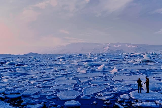
Ice World: Antarctica’s Riskiest Glacier Is Under Assault from Below and Losing its Grip
Ted Scambos
Flying over Antarctica, it’s hard to see what all the fuss is about. Like a gigantic wedding cake, the frosting of snow on top of the world’s largest ice sheet looks smooth and unblemished, beautiful and perfectly white. Little swirls of snow dunes cover the surface.
But as you approach the edge of the ice sheet, a sense of tremendous underlying power emerges. Cracks appear in the surface, sometimes organized like a washboard, and sometimes a complete chaos of spires and ridges, revealing the pale blue crystalline heart of the ice below.
As the plane flies lower, the scale of these breaks steadily grows. These are not just cracks, but canyons large enough to swallow a jetliner, or spires the size of monuments. Cliffs and tears, rips in the white blanket emerge, indicating a force that can toss city blocks of ice around like so many wrecked cars in a pileup. It’s a twisted, torn, wrenched landscape. A sense of movement also emerges, in a way that no ice-free part of the Earth can convey – the entire landscape is in motion, and seemingly not very happy about it.
Antarctica is a continent comprising several large islands, one of them the size of Australia, all buried under a 10,000-foot-thick layer of ice. The ice holds enough fresh water to raise sea level by nearly 200 feet.
Its glaciers have always been in motion, but beneath the ice, changes are taking place that are having profound effects on the future of the ice sheet – and on the future of coastal communities around the world.
Breaking, thinning, melting, collapsing
Antarctica is where I work. As a polar scientist I’ve visited most areas of the ice sheet in more than 20 trips to the continent, bringing sensors and weather stations, trekking across glaciers, or measuring the speed, thickness and structure of the ice.
Currently, I’m the U.S. coordinating scientist for a major international research effort on Antarctica’s riskiest glacier – more on that in a moment. I have gingerly crossed crevasses, trodden carefully on hard blue windswept ice, and driven for days over the most monotonous landscape you can imagine.

A map of Antarctica seen from above, most of it the ice sheet, shows the velocity of the ice flow ice. Thwaites Glacier is on the left. NASA’s Goddard Space Flight Center Scientific Visualization Studio
For most of the past few centuries, the ice sheet has been stable, as far as polar science can tell. Our ability to track how much ice flows out each year, and how much snow falls on top, extends back just a handful of decades, but what we see is an ice sheet that was nearly in balance as recently as the 1980s.
Early on, changes in the ice happened slowly. Icebergs would break away, but the ice was replaced by new outflow. Total snowfall had not changed much in centuries – this we knew from looking at ice cores – and in general the flow of ice and the elevation of the ice sheet seemed so constant that a main goal of early ice research in Antarctica was finding a place, any place, that had changed dramatically.
But now, as the surrounding air and ocean warm, areas of the Antarctic ice sheet that had been stable for thousands of years are breaking, thinning, melting, or in some cases collapsing in a heap. As these edges of the ice react, they send a powerful reminder: If even a small part of the ice sheet were to completely crumble into the sea, the impact for the world’s coasts would be severe.
Like many geoscientists, I think about how the Earth looks below the part that we can see. For Antarctica, that means thinking about the landscape below the ice. What does the buried continent look like – and how does that rocky basement shape the future of the ice in a warming world?
Visualizing the world below the ice
Recent efforts to combine data from hundreds of airplane and ground-based studies have given us a kind of map of the continent below the ice. It reveals two very different landscapes, divided by the Transantarctic Mountains.
In East Antarctica, the part closer to Australia, the continent is rugged and furrowed, with several small mountain ranges. Some of these have alpine valleys, cut by the very first glaciers that formed on Antarctica 30 million years ago, when its climate resembled Alberta’s or Patagonia’s. Most of East Antarctica’s bedrock sits above sea level. This is where the city-size Conger ice shelf collapsed amid an unusually intense heat wave in March 2022.

Below the ice, recent studies have mapped Antarctica’s bedrock and show much of the west side is below sea level.
In West Antarctica the bedrock is far different, with parts that are far deeper. This area was once the ocean bottom, a region where the continent was stretched and broken into smaller blocks with deep seabed between. Large islands made of volcanic mountain ranges are linked together by the thick blanket of ice. But the ice here is warmer, and moving faster.
As recently as 120,000 years ago, this area was probably an open ocean – and definitely so in the past 2 million years. This is important because our climate today is fast approaching temperatures like those of a few million years ago.
The realization that the West Antarctic ice sheet was gone in the past is the cause of great concern in the global warming era.
Early stages of a large-scale retreat
Toward the coast of West Antarctica is a large area of ice called Thwaites Glacier. This is the widest glacier on earth, at 70 miles across, draining an area nearly as large as Idaho.
Satellite data tell us that it is in the early stages of a large-scale retreat. The height of the surface has been dropping by up to 3 feet each year. Huge cracks have formed at the coast, and many large icebergs have been set adrift. The glacier is flowing at over a mile per year, and this speed has nearly doubled in the past three decades.
This area was noted early on as a place where the ice could lose its grip on the bedrock. The region was termed the “weak underbelly” of the ice sheet.
Some of the first measurements of the ice depth, using radio echo-sounding, showed that the center of West Antarctica had bedrock up to a mile and a half below sea level. The coastal area was shallower, with a few mountains and some higher ground; but a wide gap between the mountains lay near the coast. This is where Thwaites Glacier meets the sea.
This pattern, with deeper ice piled high near the center of an ice sheet, and shallower but still low bedrock near the coast, is a recipe for disaster – albeit a very slow-moving disaster.
Ice flows under its own weight – something we learned in high school earth science, but give it a thought now. With very tall and very deep ice near Antarctica’s center, a tremendous potential for faster flow exists. By being shallower near the edges, the flow is held back – grinding on the bedrock as it tries to leave, and having a shorter column of ice at the coast squeezing it outward.
If the ice were to step back far enough, the retreating front would go from “thin” ice – still nearly 3,000 feet thick – to thicker ice toward the center of the continent. At the retreating edge, the ice would flow faster, because the ice is thicker now. By flowing faster, the glacier pulls down the ice behind it, allowing it to float, causing more retreat. This is what’s known as a positive feedback loop – retreat leading to thicker ice at the front of the glacier, making for faster flow, leading to more retreat.
Warming water: The assault from below
But how would this retreat begin? Until recently, Thwaites had not changed a lot since it was first mapped in the 1940s. Early on, scientists thought a retreat would be a result of warmer air and surface melting. But the cause of the changes at Thwaites seen in satellite data is not so easy to spot from the surface.
Beneath the ice, however, at the point where the ice sheet first lifts off the continent and begins to jut out over the ocean as a floating ice shelf, the cause of the retreat becomes evident. Here, ocean water well above the melting point is eroding the base of the ice, erasing it as an ice cube would disappear bobbing in a glass of water.

Warming water is reaching under the ice shelf and eroding it from below.
Water that is capable of melting as much as 50 to 100 feet of ice every year meets the edge of the ice sheet here. This erosion lets the ice flow faster, pushing against the floating ice shelf.
The ice shelf is one of the restraining forces holding the ice sheet back. But pressure from the land ice is slowly breaking this ice plate. Like a board splintering under too much weight, it is developing huge cracks. When it gives way – and mapping of the fractures and speed of flow suggests this is just a few years away – it will be another step that allows the ice to flow faster, feeding the feedback loop.
Up to 10 feet of sea level rise
Looking back at the ice-covered continent from our camp this year, it is a sobering view. A huge glacier, flowing toward the coast, and stretching from horizon to horizon, rises up to the middle of the West Antarctic Ice Sheet. There is a palpable feeling that the ice is bearing down on the coast.
Ice is still ice – it doesn’t move that fast no matter what is driving it; but this giant area called West Antarctica could soon begin a multicentury decline that would add up to 10 feet to sea level. In the process, the rate of sea level rise would increase severalfold, posing large challenges for people with a stake in coastal cities. Which is pretty much all of us.
(Ted Scambos is Senior Research Scientist, CIRES, University of Colorado Boulder. Courtesy: The Conversation, an Australia-based nonprofit, independent global news organization dedicated to unlocking the knowledge of experts for the public good.)
❈ ❈ ❈
Inferno: Climate Disaster Is Turning the Planet into a Tinderbox
Jane Braxton Little
Mike Savala’s boots scuffed the edge of a singed patch of forest littered with skinny fingers of burnt ponderosa pine needles. Nearby, an oak seedling sizzled as a yellow-shirted firefighter hit it with a stream of water. Spurts of smoke rose from blackened ground the size of a hockey rink. A 100-foot Ponderosa pine towered overhead.
“Third response today,” said Savala, shaking his head.
This hillside in my own backyard in California’s northern Sierra Nevada mountains hadn’t seen lightning for months and yet it had still burst into flames. All summer long, it had baked in heat that extended into an unseasonably hot autumn. Now, in late October, it was charred by a fire of mysterious origin. A spark from a wandering hiker? An errant ember from a burn pile? Spontaneous combustion?
Savala, a fire-crew boss for the Greenville Rancheria of Maidu Indians, scanned the sky. Cloudless. There had only been three inches of precipitation since July 1st — 15% of normal. And no wonder, since California is in the throes of its fourth dry year. More than 95% of the state is now classified as under severe or extreme drought.
Although small and easily contained, this tiny fire in rural northeastern California was another wake-up call, up close and personal, about an ominous trend. A warming planet and changing land use are fueling a dramatic surge in forest fires worldwide. Terrifying projections forecast a 57% increase in extreme fires globally by century’s end. The indisputable cause: climate change.
“The heating of the planet is turning landscapes into tinderboxes,” a team of 50 researchers from six continents reported in “Spreading Like Wildfire: The Rising Threat of Extraordinary Landscape Fires,” published this year by the United Nations Environment Program. That document describes what can only be viewed as a future flaming version of planetary collapse that could push humanity perilously close to a precipice of no return.
Like dozens of previous reports from the U.N. and other international organizations, it describes a situation that, while dire, isn’t yet hopeless. Despite those ever stronger, hotter, drier winds that will fan the flames, governments could slow climate change by improving their forest management techniques, planning and preparing far better, and communicating more effectively. To reduce the likelihood of future mega-fires means working with forests where fire is an element as essential to ecosystems as sunshine or rain. It also means working with forest communities, where local knowledge accumulated over generations is too often shunned. And of course, it means honestly confronting our reluctance to ween ourselves from the fossil fuels that power our factories, cars, and those absurdly unnecessary leaf blowers that are backing us toward the cliff.
A Fiery Feedback Loop
If my small backyard fire was a personal wake-up call, the 2021 Dixie fire was a four-alarm blaze. On its rampage from the Feather River Canyon through Lassen Volcanic National Park and beyond, it destroyed my adopted town of Greenville, 160 miles northeast of San Francisco. In fact, it torched close to a million acres. Nearly half of them burned so intensely that the once-majestic, now blackened pine and fir forests there may never again support the biologically diverse ecosystems that drew me here so long ago.
The single-largest fire in California’s history, Dixie was part of a record-breaking fire year globally. Around the world, fires burned nearly 23 million acres, an area almost the size of Portugal. Dixie contributed to the worldwide loss to fire of more than a third of the tree cover that disappeared in those 12 months, according to a report from the World Resources Institute. And this is only a preview of what’s to come. Scientists believe that there may be a 30% increase in extreme fires globally by 2050.
Such an acceleration of forest fires will, it seems, spare few parts of the world. Fires, burning longer and hotter, are already flaring in unexpected places, shattering assumptions about what’s safe, let alone normal. Even the Arctic, that remote expanse of sea ice, treeless permafrost, and minus 40-degree Celsius temperatures, home to polar bears, lemmings, and snowy owls, is now beginning to burn. After July 2019, the hottest month on record so far, fires erupted across the Arctic Circle in Alaska, Greenland, and Siberia. As temperatures soared to as much as six degrees Celsius above normal, flames spurted across an expanse of tundra larger than England.
Arctic fires are particularly worrisome because of the vast amounts of carbon locked beneath that frozen soil. Much of it, after all, is peatlands, largely formed at the end of the last ice age, 12,000 years ago. Although it covers just 3% of the Earth’s surface, peat sequesters 42% of the carbon stored in all other types of vegetation, including the world’s forests. Global warming is now drying out that peat, making it ever more susceptible to fire. As it burns, of course, it releases that carbon.
Nor is such a bio-feedback loop limited to the Arctic. As the world becomes hotter and drier, the carbon we emit from our reliance on fossil fuels is drying out forests everywhere, making them ever more prone to burn, while extending burning seasons globally. Firefighters in California used to don fire-resistant Nomex shirts in May or June, knowing they could shed them by mid-October. Now, there’s barely a pause before things heat up again and those shirts go right back on.
As wildfires are transformed into year-round challenges, the carbon they release only further contributes to emissions from other sources, making it that much more difficult to halt rising temperatures. Think of it as a mutually exacerbating feedback loop: wildfires are worsened by climate change, which, in turn, is intensified by the ever-fiercer wildfires.
Management for Better — or Worse
Forests around the world evolved with fire, hosting species that came to depend on its cleansing power for renewal and the flushes of nutrients it releases. Indigenous people understood this and learned to live with fire. Over the last century, however, many forests have been fundamentally altered by a misunderstanding of its essential role in forest resilience. While climate change is indeed the primary driver of the global increase in wildfires, forest management has played its own substantive and mostly negative role in that increase by overemphasizing the importance of fire suppression.
Scientists and policymakers are urging fire-fighting agencies to rethink their use of financial and human resources. Instead of focusing primarily on how many crews can be mustered for fire suppression, the emphasis should shift to planning and prevention. Most countries devote less than 0.2% of their wildfire expenditures to such planning, according to U.N. researchers. In the United States, just 40 cents of every dollar spent on managing wildfires goes toward reducing fire risk or helping forest communities like mine recover in ways that could make them more resilient.
“There isn’t the right attention to fire from governments,” says Glynis Humphrey, a fire expert at the University of Cape Town and one of those U.N. researchers.
Whether it’s the collapse of forest ecosystems before our eyes or the trauma of entire towns like Greenville burning up in raging infernos, forest managers are slowly starting to respond to the global crisis — with sadly mixed results.
A wave of deadly fires in Portugal in 2017 that killed 117 people and ravaged 1.3 million acres evoked fierce popular condemnation of the government’s response, prompting that country to adopt an aggressive 20-year plan to transform its fire management. It aims to use fire as a tool, while increasing understanding of its positive role in such a heavily forested country. Prime Minister Antonio Costa has restricted funding aimed at combatting fires to less than 10% of the total spent, while rural communities are to become more involved in protecting their homes and businesses. However, his new plan was barely launched last summer when temperatures of up to 45 degrees Celsius (113 degrees Fahrenheit) and 40-mile-per-hour winds contributed to yet another series of out-of-control wildfires, forcing evacuations of whole communities and a nationwide state of emergency.
Throughout the western United States, a century of public policy committed to suppressing all wildfire has left our forests unnaturally crammed with small-diameter trees and brush. Scientists documented as much as a sevenfold increase in tree density in the Sierra mountains between 1911 and 2011. While large old-growth trees have evolved to live with fires, those small trees and shrubs form an unnatural bed of fuel for future infernos. As a result, blazes in the West increased by seven large fires a year from the mid-1980s through 2011, according to a study by scientists at the University of Utah and the University of California, Berkeley.
What needs to be done is clear, says Scott Stephens, a professor of fire science at Berkeley. “Active stewardship is the only way we’ll ever get out of this.”
In California, state and federal officials have committed to reducing the threat of catastrophic wildfires by returning fire to the forest ecosystems that evolved with it. They’ve set a goal of igniting planned fires to burn away such brush and seedlings on one million acres annually. In September 2021, Governor Gavin Newsom signed legislation allocating $1.5 billion to wildfire mitigation projects, the largest such investment in state history. Last January, the federal government also announced a $600 million program to support California’s wildfire recovery efforts. As well-intentioned as such programs may be, however, they have so far fallen well short of their objective. Fire managers hope that, in 2022, they will have set prescribed burns on 200,000 acres, only 20% of the goal. Add in logging to thin overcrowded stands of trees and they may reach 300,000 acres.
Amid the frightening statistics on rising temperatures and scorched acres, an 8,800-acre area in California demonstrates the potential for active management to reduce the dangers of destructive wildfires. In 2019, Forest Service crews set intentional fires on the western slopes of the central Sierra Nevada near Caples Lake. Last summer, when the 222,000-acre Caldor fire roared through there en route to South Lake Tahoe, it left a finger of green where prescribed fires had reduced the forest’s fuels. While that was only a small island of resilience, consider it an enormous example of possibility.
The Promise of Technology
Some of the government agencies most criticized for their management of wildfires are now turning to technology to help detect them before they turn into infernos. In this, they are not alone globally. Take Australia, where fires in the catastrophic 2019-2020 summer season, the worst in that country’s recorded history, killed 34 people directly and another 445 through smoke inhalation. Often sparked by lightning at a time of warmer-than-average temperatures and lower-than-average precipitation, they destroyed about 6,000 buildings and killed an estimated 1.5 billion animals. In response, last year, Australia launched a satellite system connected to ground-based cameras and aerial drones meant to spot any fire within one minute of ignition.
Sonoma County, California, has similarly been testing fire-detecting artificial intelligence technology for two years now. In 2017, that area just north of San Francisco was devastated by the deadly 37,000-acre Tubbs fire. Three other fires followed in 2019 and 2020. In 2021, county officials linked artificial intelligence software to an already existing system of tower-mounted cameras. Called ALERTWildfire, it snaps photographs every 10 seconds, exposing smoke and flames. The AI sifts through the camera images in a fashion designed to increase the speed of detecting such blazes and so getting firefighters to them faster.
After the first full season, the results, however, were anything but overwhelming: AI detections beat humans in spotting fires only once out of every 10 times. Now, managers are directing their AI-adapted cameras to look for fires where humans are unlikely to spot them — as Sam Wallis, a community alert and warning manager, put it: the fires “way out in the middle of nowhere, the ones that really scare us.” He’s also optimistic about AI’s potential for detecting nighttime fires, which can smolder in the forest duff for significant periods before bursting into uncontrollable flames. Overall, Wallis said, “the AI is not a silver bullet, but it is a bullet.”
Last year, Pacific Gas and Electric also began adding AI software similar to the kind Australia is testing to its network of cameras. It’s a better-late-than-never effort to reduce the number of deadly wildfires sparked all too notoriously by its own faulty equipment. The company has, after all, been implicated in at least five major California wildfires including the Dixie one.
Then there are the “dragon eggs.” The Forest Service is dropping those ping-pong-sized balls from remote-controlled aircraft to start controlled burns designed to return fire to its natural role of keeping forest fuels more balanced. The chemicals in the spheres ignite when they hit the ground. During the Dixie fire, drones dropped such incendiary balls on a mountainside ahead of the advancing flames to start what’s known as a backfire and did indeed create a fire-unfriendly zone in its wake.
Such management efforts may prove effective both in returning forest stands to a state of fire resilience and in curbing runaway blazes. They don’t, however, relieve officials of what many consider their unconscionable failure to enact the most basic laws to curb the greenhouse gases that are driving such climate-change-induced disasters. Apocalyptic scenes — cities blanketed in smoke, vast landscapes left lifeless — have prompted proposals before the U.N. to include “ecocide” as the 5th international crime, alongside genocide, crimes against humanity, war crimes, and crimes of aggression.
Sadly, humanity may already have passed the point of simply managing ourselves out of the fiery apocalypse scientists predict we’re heading for. Global mean surface temperatures are already up 1.09 degrees Celsius and rising. The precipice looms.
Yes, technology can help and, if the feet of agencies are held to the proverbial flames they’re committed to managing more effectively, the oncoming inferno may yet be slowed, if not halted altogether. But if we don’t take responsibility for what’s happening, all our talk, all that bureaucratic lingo about creating a low-carbon economy and hitting net zero in greenhouse gas emissions by 2050 may be little more than what environmental activist Greta Thunberg has called the “blah blah blah.”
Still, hope is empowering and activity galvanizing. While it’s taken far too many destroyed towns to get there, California, at least, is beginning to grasp what’s needed to live with fire. Both cultural and monetary support is now strong — and growing — for prescribed burns and fuel-treatment projects. And so, locally, we take chainsaws to the smaller trees overcrowding our woods, using what we remove to heat our homes. We prune the branches from the large fire-resilient trees, chopping them to fit our stoves. We rake the small debris and forest litter into burn piles, wishing we had a way to utilize those forest products, too, instead of adding to the very emissions we’re trying to reduce. And we keep on igniting small, safe burns to return resilience to these lands that once enjoyed the benefits of fire. On such a planet in such a time, the question remains: Will any of it be enough to live with the fire next time?
Days after our backyard blaze flared up, it snowed: eight inches of reassurance that this fire, at least, would not smolder and restart. But by the end of November, the Sierra had no additional rain and state officials were at the edge of declaring a fourth year of drought. Somewhere in our future, the inferno still lurks.
(Jane Braxton Little is an independent journalist who writes about science and natural resources for publications that include the Atlantic, Audubon, National Geographic, and Scientific American. She moved to Plumas County in 1969 for a summer that has yet to end. Courtesy: TomDispatch, a web-based publication, founded and edited by Tom Engelhardt, aimed at providing “a regular antidote to the mainstream media”.)